Less than a month after we returned
to Nampula from Beira, helping out with the Cyclone Idai response, Cyclone Kenneth hit north
of the city of Pemba (north of Nampula). Kenneth is considered the to be the strongest Cyclone to hit Mozambique in modern recorded history. Again, MAF immediately deployed
DR team members ahead of the storm so that we could send the Caravan to Pemba
the day after the storm struck the Mozambican coastline. We were the first aircraft to arrive on the scene. The
next day, an aerial survey was completed to survey and map the affected areas
to share with the government and the responders coming to aid affected
people. It was apparent that islands of Ibo and Matemo were quite hard
hit as well as multiple villages on the mainland.
 |
| Getting ready for the survey flight and visit to Ibo Island (L. Hibberd) |
 |
| Survey Photo of destruction (J. Gorenflo) |
 |
| Damage at Mecujo |
That same day, the team walked
around Ibo Island to talk to the residents and survey the damage. There
were no communication services on Ibo which made it difficult to coordinate aid
efforts. Learning the lesson from Cyclone Idai, MAF chose to send its VSAT
(high speed satellite data communication) equipment to Mozambique for Cyclone
Kenneth and after this visit decided it would be put to use best on Ibo.
On a future flight the equipment was brought to the island and set up by MAF's
expert, John G. He stayed on the island and helped connect the constant
influx of aid workers coming and going to the island. Later after John left,
another MAF tech guy, Lukas, came and continued to make sure the equipment was
operational. They also help coordinate passengers and cargo as it arrived
on the island.
 |
| Dave showing Ibo Island residents pictures on the iPad (R. Emenaker) |
 |
| John G. with the VSAT equipment (L. Hibberd) |
 |
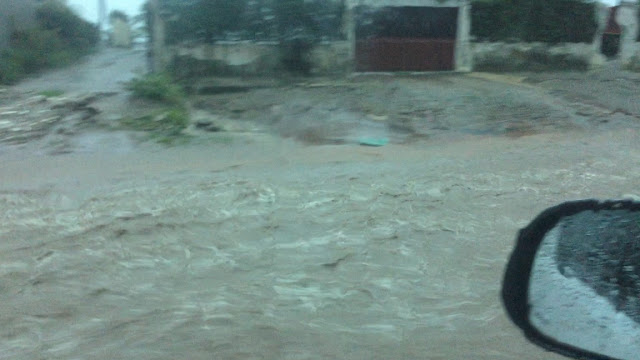
| Pemba roads flowing with water after the storm (D. Holmes) |
Finally, after a break in the
weather, our Caravan was able to start delivering aid, including shelter and
food, to Ibo Island. At logistics meetings and through coordinating with
INGC (Mozambique's disaster relief branch) and aid organizations, we were able
to come up with a plan for the coming weeks. The road to Macomia was open
and accessible by vehicle so we decided that our Caravan could be better put to
use serving the affected islands that have airstrips.
 |
| Unloading High Energy Biscuits (D. Nguyen) |
Time-lapse film of flight between Ibo and Pemba (Sandra Black)
A bookings phone number, email, and
form were set up so we could offer regular shuttle flights between Pemba,
Ibo, and Matemo. There was a morning and afternoon shuttle for passengers
with space between for cargo flights and additional passengers as needed.
We also partnered with a local organization to transport family kits of food to
Ibo every time there was empty space on the plane. You can read more
about this on MAF's storyhub.
Here is a GoPro
video Dave recorded flying from Pemba to Ibo Island. Check out
the beautiful coastline and the awesome shortfield landing!
We also flew two more aerial
surveys. One was to examine the wider area and make sure the government
was aware of all of the smaller affected villages. The other was to look
survey roads and powerlines for the public works department. We
photographed numerous bridges washed out and created another map with
geo-referenced photos.
 |
| One of numerous bridges washed out (J. Holmes) |
 | |||||
| Jill with the wife of the Governor |
Time-lapse
video of a landing at Ibo
Over
the three week period we flew:
29.6
metric tons of cargo
469
passengers
111
flight legs
Served
24 organizations
Our
VSAT equipment served:
11
organizations
over 60 users